Monitoring from the Air
2021 Stewardship Season
As part of OLT’s stewardship obligation, we must annually monitor all 11,000 acres of conservation easement land, and 800 acres of fee land. For the last thirty years, OLT staff and volunteers have met this obligation by strapping on our hiking boots and walking each property.
We have covered a lot of ground by foot (and sometimes by canoe), but as more and more land became protected, OLT began exploring alternative methods for monitoring properties.
In the Spring of 2021, OLT was one of 18 land Trusts from across the country to receive a grant from The Land Trust Alliance and The Nature Conservancy California to pilot remote monitoring technologies, including satellite imagery and drone photography.
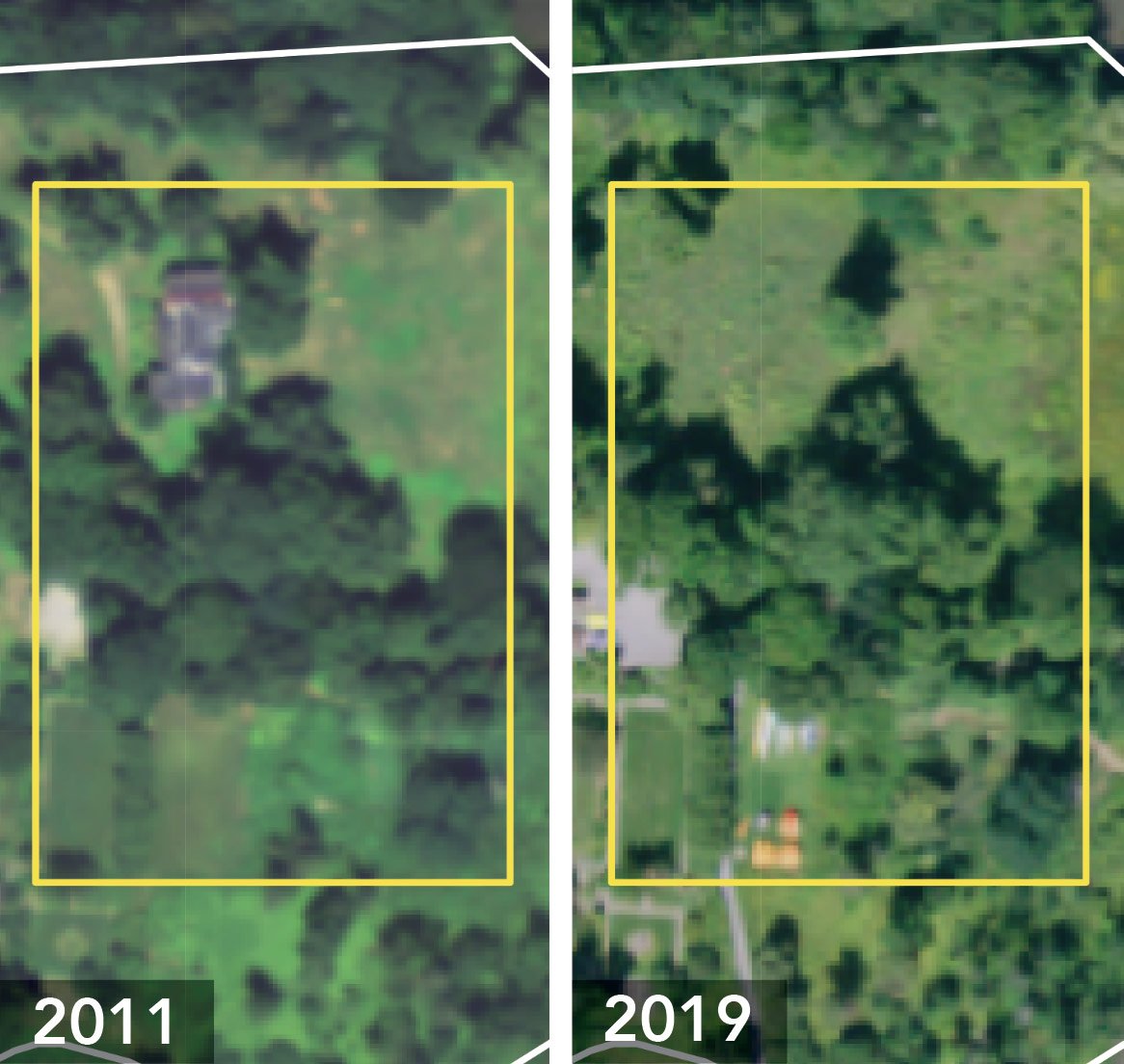
The LENS satellite image viewer allows OLT staff to compare property images to previous years; see new structures or measure changes to fields, wetlands and forests. Here you see an example from Brookwood Point. The 2011 image shows the area with old house that was once on the property, the 2019 image shows it gone.
While these technologies have existed for many years, they had previously been cost-prohibitive for our small land trust. However, during the pandemic we began to explore remote monitoring more seriously, as staff members could not come into the office or meet face to face with landowners.
With funding from this grant, OLT partnered with a company to obtain high resolution imagery of all of our conservation easement and fee properties. We also consulted with a local drone operator to collect aerial imagery on select properties.
Our hope is that these technologies will not only save us time and transportation costs, but allow us to better measure and understand changes on conservation properties over time, or in response to certain pressures (i.e., increases or decreases in population, changes in farming or timber practices, climate change, etc.)
Remote monitoring gives us the power to measure accurately the impact of private land conservation, here and across the country. And most importantly, our staff can work more efficiently, saving time and money to conserve more of our precious landscape before it is too late.
By May Leinhart


